Temporary dewatering was necessary at some Station, Portal, Shaft and Cross Passage construction sites to ensure ground stability, to control inflows into open excavation and to allow safe construction.
The potential effects of these temporary dewatering works were anticipated in the Project Environment Statement (ES).
During the dewatering works, monitored groundwater level and quality was carried out at each dewatering site. This information was regularly collated, interpreted and reported to demonstrate that the impact on groundwater resources and receptors from the dewatering activities were within acceptable limits and were suitably mitigated.
This close-out report summarises the history and key characteristics of the Crossrail project’s deep aquifer dewatering works and discusses its impacts.
It was found that the temporary effect of the Crossrail dewatering was significant. At peak Crossrail abstraction, a drawdown cone of 5.9 km x 7 km in plan was created, with a maximum drawdown in the Chalk of about 35m.
With termination of Crossrail dewatering, the drawdown cone induced by the works has now fully dissipated. The residual cone that remains is due to continued groundwater abstraction at Canary Wharf Station by Canary Wharf Contractors. This is being undertaken for ongoing non-Crossrail project works in that area.
The report concludes that:
- The temporary impacts of the Crossrail dewatering works have all dissipated.
- No permanent adverse impacts remain as a result of the dewatering works.
- No derogation of the abstraction rights of licensed third party abstractors was observed or reported during the dewatering works.
- Crossrail has therefore met the obligations with respect to dewatering set out in the Crossrail Act and in all other relevant agreements and licences.
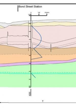
The Geological long section with pore pressure profiles
This drawing provides a series of groundwater pressure profiles along the route’s alignment. The profiles are based on data collected up to August 2011. This date was relatively early in the construction process and in some cases before significant Crossrail construction dewatering took place. The actual pore pressure profiles present at given any time are likely to vary from those shown. The geological background on the long section is an earlier version of the section found in Crossrail Geological Long Section: Post Construction Update. That revised section shows an updated geological interpretation based on additional data gathered during the Crossrail works.


